AgriNav-Sim2Real: A Multi-Sensor Dataset for Drone/UGV Navigation in Greenhouses (Synthetic + Real)

1University of California, Los Angeles 2Cruise

empty


Abstract

We introduce AgriNav-Sim2Real, a large-scale dataset for greenhouse navigation that bridges synthetic (Unreal Engine + AirSim) and real (handheld/UGV/drone) captures. 
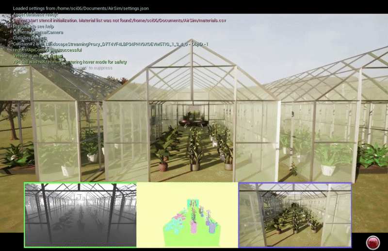
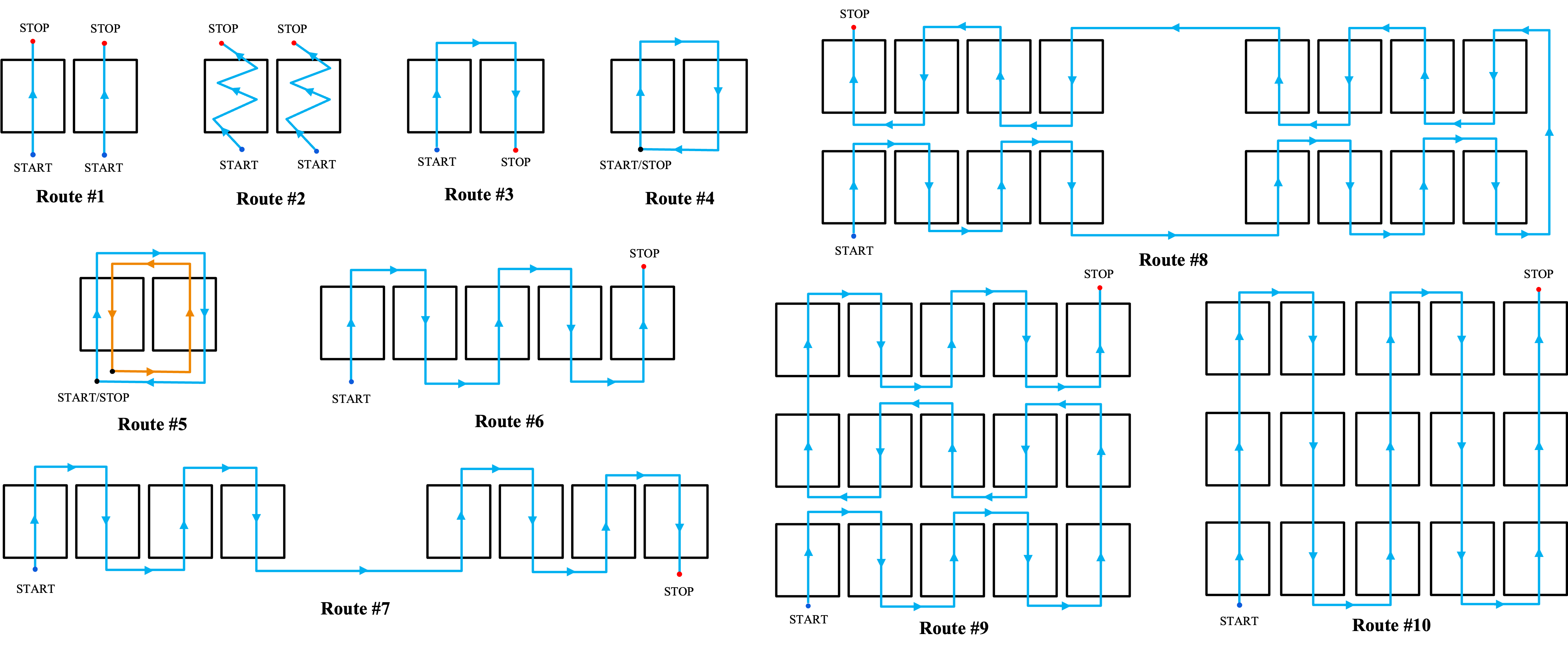
The synthetic split provides RGB, Depth, Semantic Segmentation, LiDAR, IMU, and GPS/pose data in a 3×5 connected-greenhouse with 10 canonical routes (loop, straight, zig-zag, in/out), rendered at a resolution of 960×540 px. 
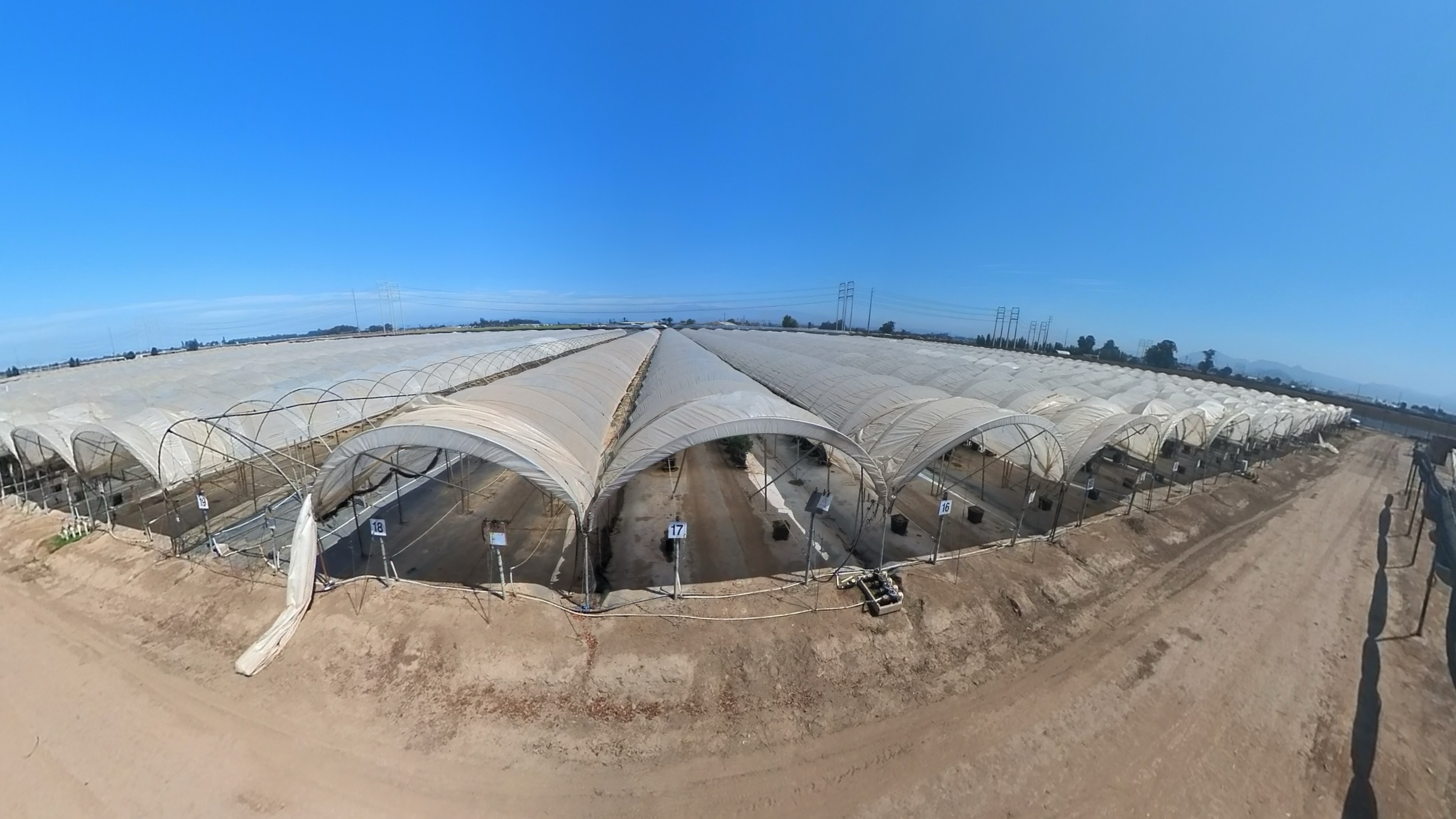
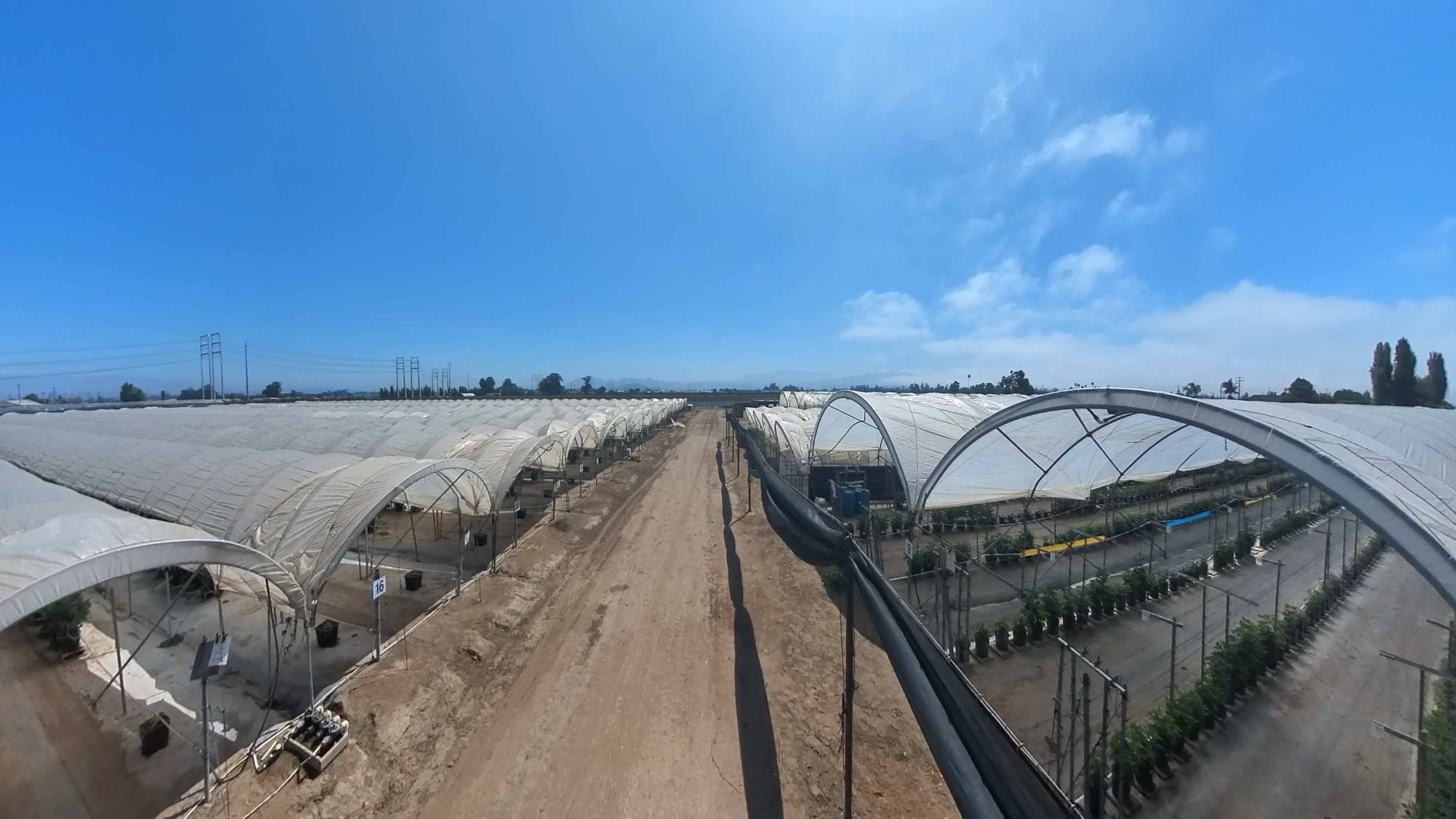
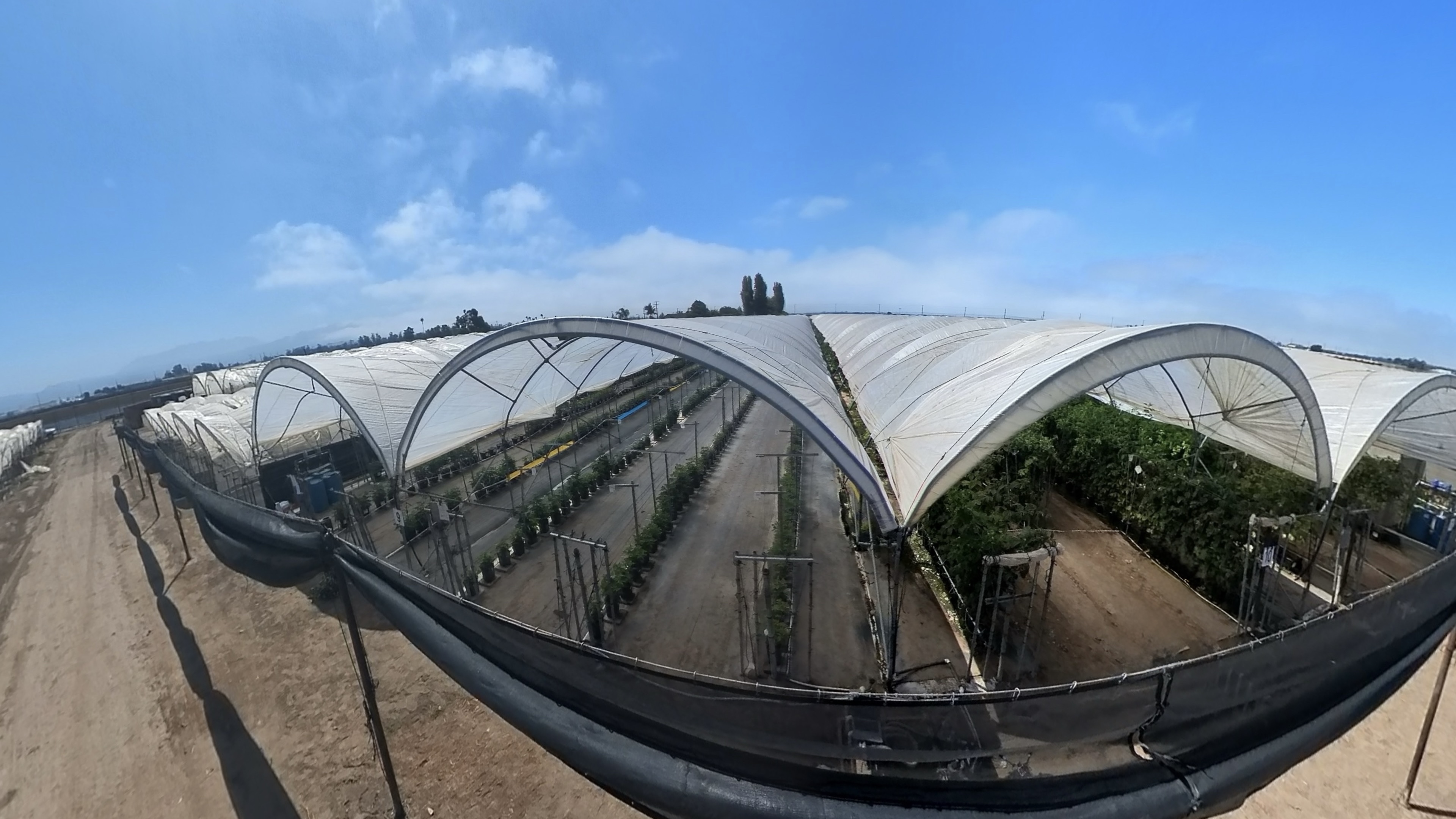
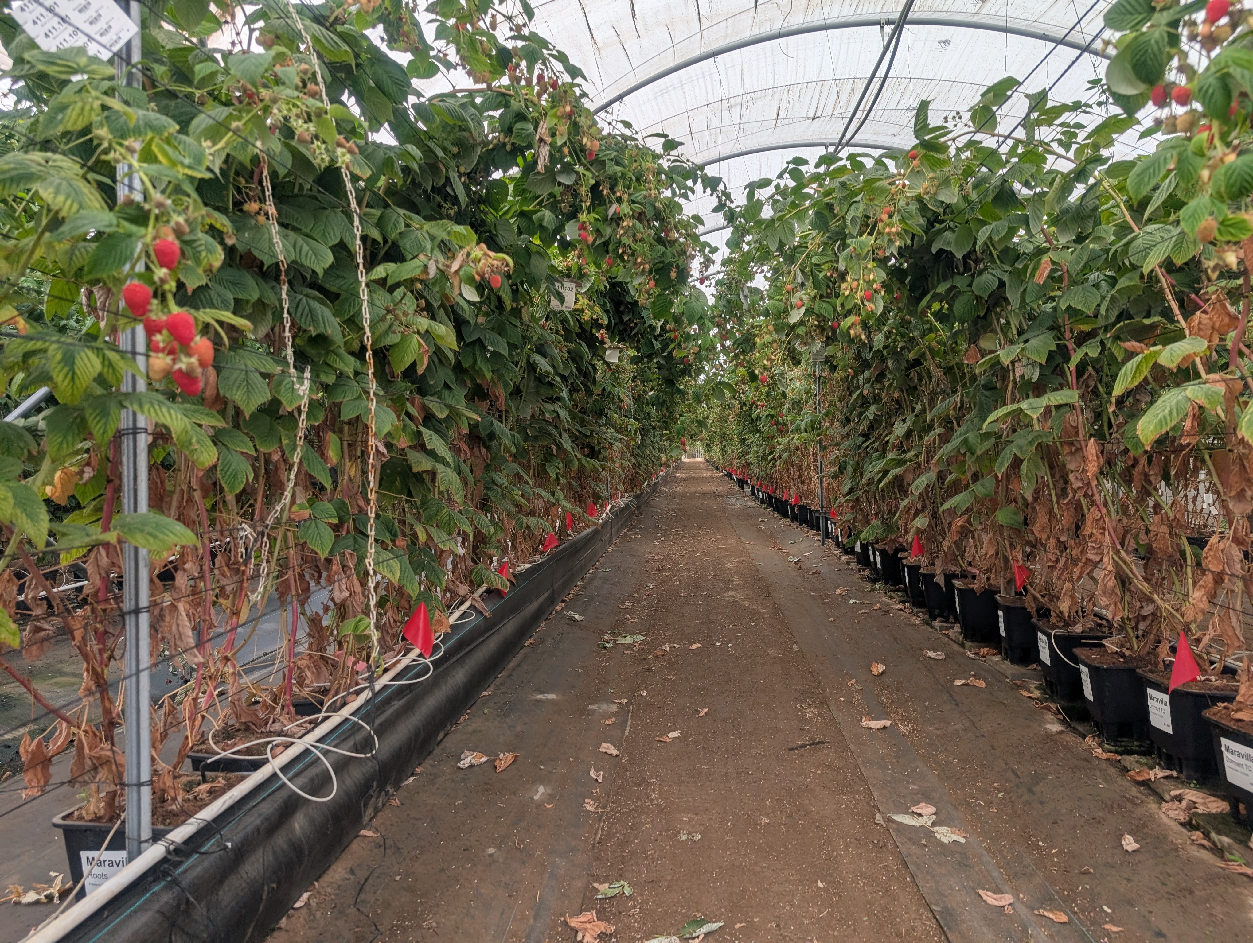
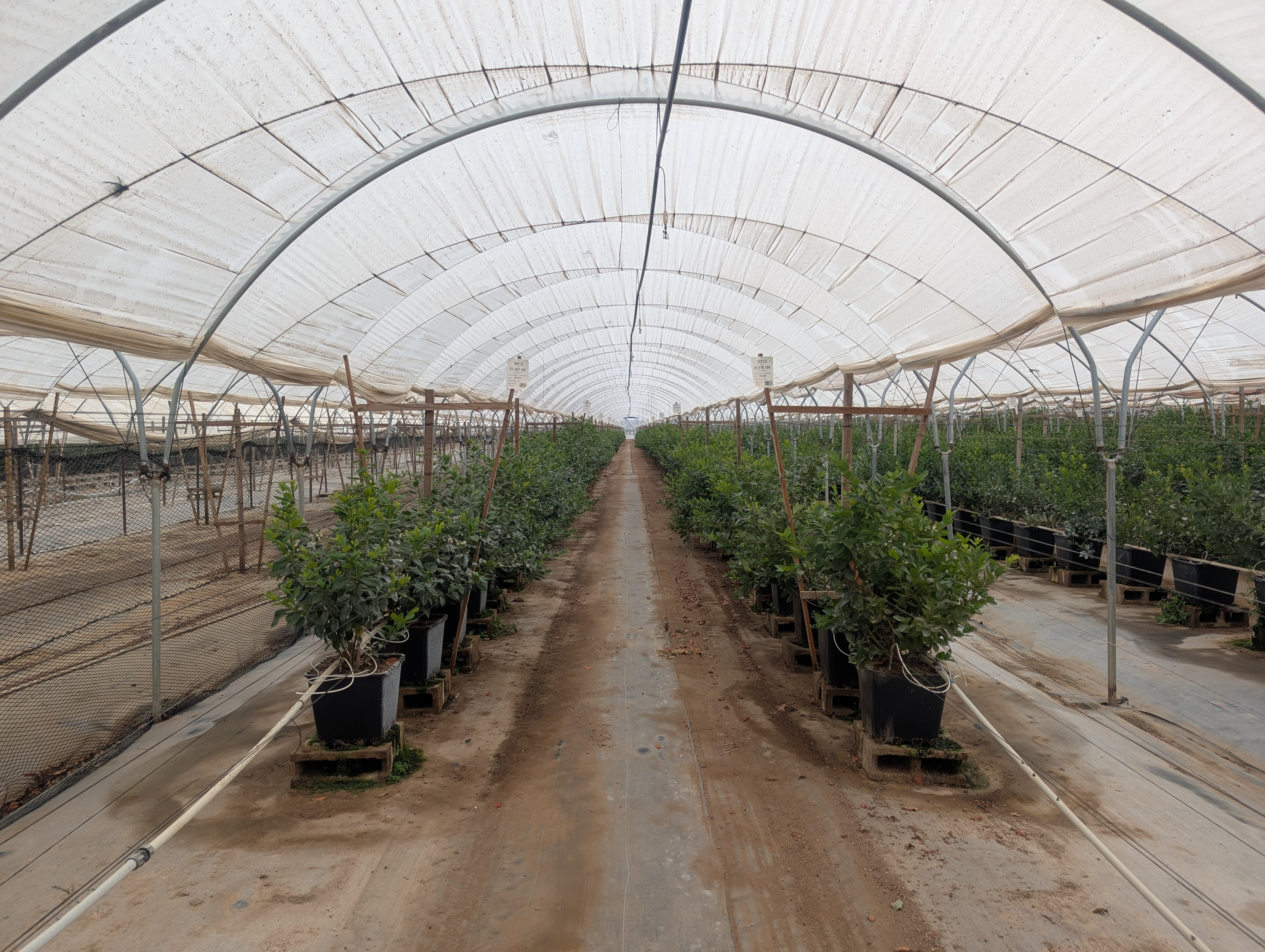
The real split offers ZED2i RGB-D, Alvium NIR, and IMU recordings across multiple farm sessions, with optional Insta360 360° context, captured at 3840×2160 px resolution.

In total, the dataset contains 847,243 files (15 videos, 674.3 GB), organized with timestamp-based filenames shared across modalities for straightforward synchronization and consistent folder layout for loaders and baselines.

We also establish a benchmark suite evaluating recent methods in object detection and semantic segmentation (e.g., YOLOv8, Mask R-CNN, SegFormer) to assess sim-to-real generalization across multi-sensor inputs (RGB, Depth, NIR).

AgriNav-Sim2Real targets tasks in navigation and obstacle avoidance, depth estimation, semantic segmentation, cross-modal fusion (RGB-D/NIR), and sim-to-real transfer (train synthetic → evaluate real).

Dataset Highlights

Synthetic Dataset Highlight✨

Modalities: RGB, Depth (PFM), Semantic Segmentation (uint8 masks), LiDAR (ASCII), IMU, GPS/pose.

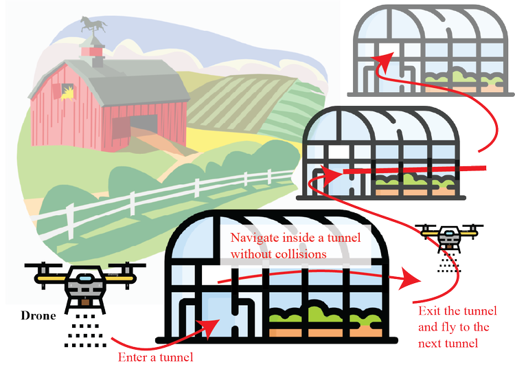
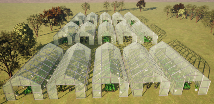
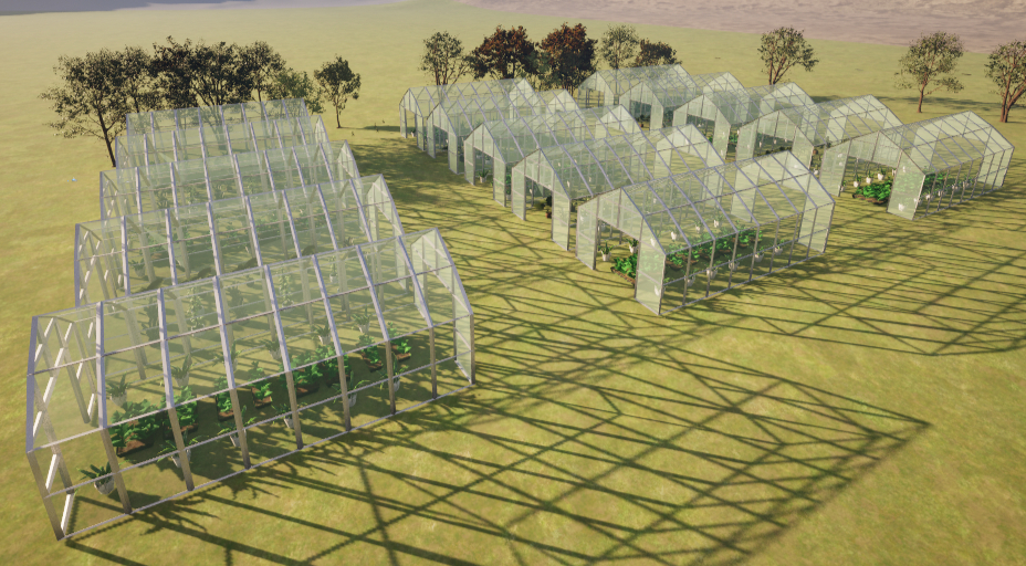
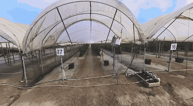
Environment: 3×5 connected greenhouses with dynamic lighting, wind, clutter, and 10 route classes (Route #1–#10) rendered via Unreal Engine + AirSim.

Organization: Per-route folder structure with timestamp-based filenames shared across modalities; optional scenes/ (for domain randomization) and routes/ (for waypoints).

Use Cases: Synthetic data pretraining, sensor fusion benchmarking, 3D reconstruction, and sim-to-real transfer learning.

Real Dataset Highlight✨

Modalities: ZED2i RGB-D + IMU; Alvium 1800 U-501 NIR; (FLIR Lepton LWIR capable but not in this release); Insta360 X3 for 360° context.

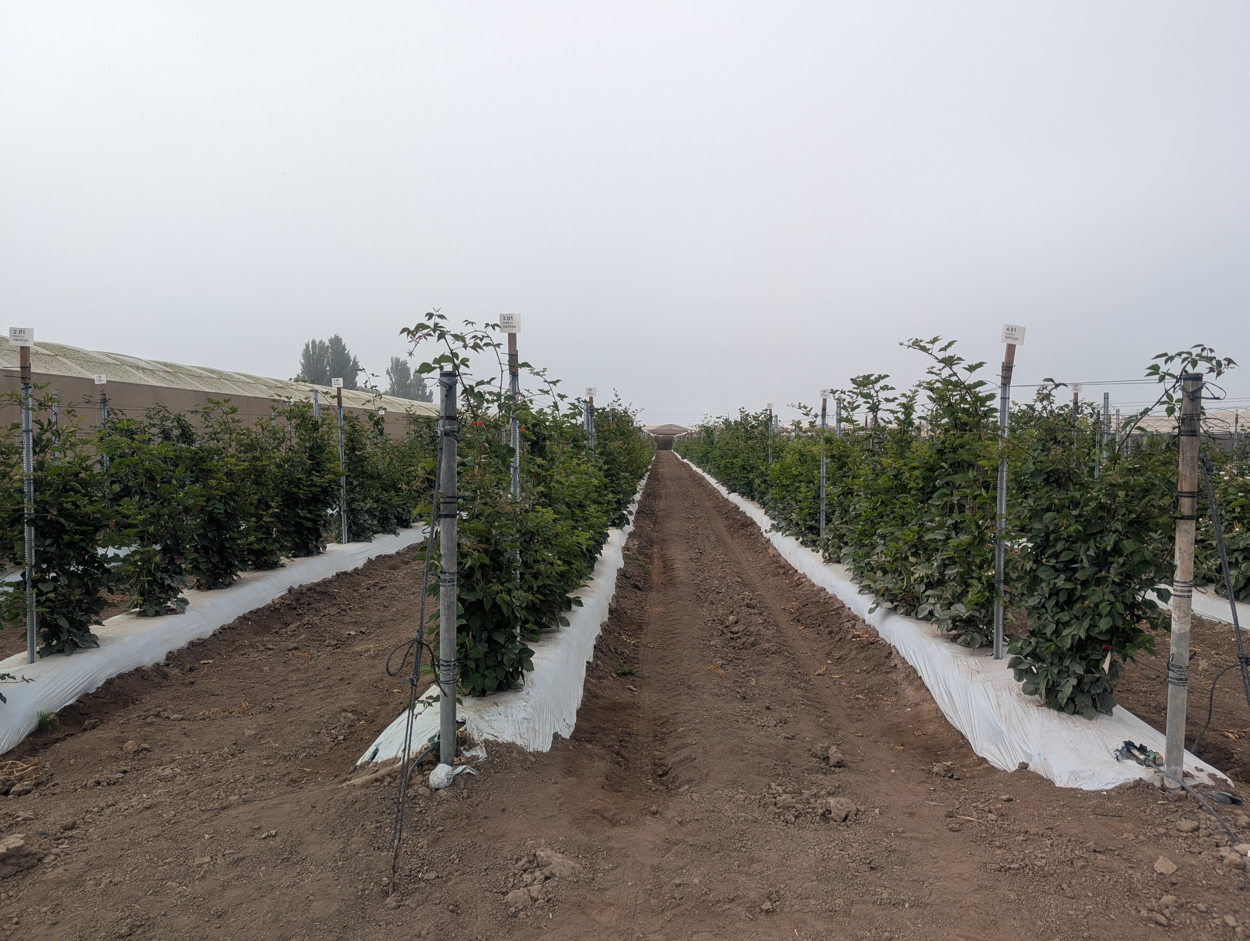
Environment: Field recordings from commercial greenhouses and open-farm setups under varying lighting, weather, and plant species (strawberries, blueberries, blackberries).

Organization: Per-session folders organized by timestamp and sensor type (e.g., nir/, imu/), synchronized for multimodal processing.

Use Cases: Real-world validation of trained navigation policies, depth estimation, and cross-modal RGB↔NIR domain adaptation.

Dataset Overview

Synthetic Data

Engine & Sim: Unreal Engine + AirSim with a 3×5 connected-greenhouse map, dynamic lights, wind, and clutter.


Front view

Side view


Demo video

Canonical Routes


We collected 10 different routes in our simulation environment.

Real Data


Farm (left)

Farm (center)

Farm (right)

Strawberries

Blueberries

Blackberries


You can view a 360 view of the Farm at here

Benchmark

We evaluated the AgriNav-Sim2Real dataset using several recent deep-learning frameworks for object detection and semantic segmentation. Our benchmark focuses on assessing cross-modal generalization between synthetic and real data splits. The evaluation includes representative architectures such as YOLOv8, Mask R-CNN, and SegFormer, with metrics reported in mAP, IoU, and F1-score across greenhouse environments.

These baselines serve as references for sim-to-real performance and highlight the challenges of domain adaptation under multi-sensor inputs (RGB, Depth, and NIR).

Ongoing Work — To Be Updated

Acknowledgements

This project was funded by the Department of Pesticide Regulation. The contents may not necessarily reflect the official views or policies of the State of California.

Citation

@inproceedings{zhu2025drone,
title={AgriNav-Sim2Real: A Multi-Sensor Dataset for Drone/UGV Navigation in Greenhouses (Synthetic + Real)},
author={Evelyn Zhu, Tuan-Anh Vu, Akshat Pandya, Russell Luo, M. Khalid Jawed},
booktitle={xxx},
year={2025}
}

License

Our AgriNav-Sim2Real dataset is made available for non-commercial purposes only.

  • You will not, directly or indirectly, reproduce, use, or convey the dataset or any content, or any work product or data derived therefrom, for commercial purposes.
  • This code is for academic communication only and not for commercial purposes. If you wish to use it for commercial applications, please contact the authors.

Redistribution and use in source and binary forms, with or without modification, are permitted provided that the following conditions are met:

  • Redistributions of source code must retain the above copyright notice, this list of conditions and the following disclaimer.
  • Redistributions in binary form must reproduce the above copyright notice, this list of conditions and the following disclaimer in the documentation and/or other materials provided with the distribution.

THIS SOFTWARE IS PROVIDED BY THE COPYRIGHT HOLDERS AND CONTRIBUTORS "AS IS" AND ANY EXPRESS OR IMPLIED WARRANTIES, INCLUDING, BUT NOT LIMITED TO, THE IMPLIED WARRANTIES OF MERCHANTABILITY AND FITNESS FOR A PARTICULAR PURPOSE ARE DISCLAIMED. IN NO EVENT SHALL THE COPYRIGHT OWNER OR CONTRIBUTORS BE LIABLE FOR ANY DIRECT, INDIRECT, INCIDENTAL, SPECIAL, EXEMPLARY, OR CONSEQUENTIAL DAMAGES (INCLUDING, BUT NOT LIMITED TO, PROCUREMENT OF SUBSTITUTE GOODS OR SERVICES; LOSS OF USE, DATA, OR PROFITS; OR BUSINESS INTERRUPTION) HOWEVER CAUSED AND ON ANY THEORY OF LIABILITY, WHETHER IN CONTRACT, STRICT LIABILITY, OR TORT (INCLUDING NEGLIGENCE OR OTHERWISE) ARISING IN ANY WAY OUT OF THE USE OF THIS SOFTWARE, EVEN IF ADVISED OF THE POSSIBILITY OF SUCH DAMAGE.